Last week Taylor and I braved the 100+ degree weather and set out to try to capture a perfect picture of the Dallas skyline. Taylor’s dad has a bunch of skyline pictures from various famous cities hanging around his office, but was missing the most important one: Dallas! With his birthday approaching, my photographerly husband decided that taking the perfect picture would make the perfect gift.
Taylor had, of course, researched the best looking pictures of the Dallas skyline…and then figured out where you would have to be to take them. Here’s the thing about a skyline picture: you have to be pretty far away to get the whole thing.
We drove out to West Dallas and parked at Trinity Overlook Park. The Trinity River is a river that passes through Dallas. You could technically call it a Texas River since all 710 miles flow entirely within the state of Texas (cool huh?). Anyway, the city of Dallas is currently working on a development project (aka The Trinity River [Corridor] Project) to redevelop the area, build parks and recreational sports areas, and basically just revive the area to make it a fun outdoorsy destination for Dallasites.
Right now from Trinity Overlook Park you can see the Dallas skyline, the Margaret Hunt Hill Bridge (you know, the one with the huge white arch that you can see when you’re driving downtown?), and a whole lota nothing. The project officially started in the 2000s…and 11 years later…there’s clearly still a lot left to do. I think it’s an awesome idea if they could get rolling again!
This is the view from the park:


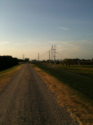
The park was just our starting point so we set off a dirt road (yes really!) to get a better view of the skyline. The first picture is the path leading forwards and the second is looking back. You can see the Margaret Hunt Hill Bridge in the distance of the second picture!


The walk took about 20 minutes (and included crossing under highway 30!) but was totally worth it for the view when we got there! This was now our view:


We set up our photo-shoot on the banks of the river and took pictures before, after, and during the beautiful sunset. Taylor spent a long time taking panorama pictures of the entire skyline…and I’m glad I had a book to read!


Taylor is still working on the final picture for his dad – but here’s a little glimpse of the work in progress:


I have to say...the Dallas skyline has certainly grown on me over the past two years! So pretty :)


No comments:
Post a Comment